all newsNews
XMtrade®/ISOT to support 15-minute trading on the day-ahead market
8/28/2025
The planned introduction of a 15-minute trading interval on the single-day-ahead electricity market ... more
Participate in the ENERGOFÓRUM® 2025 event online
8/21/2025
Under the organisational leadership of our company, energy experts will meet for the nineteenth time... more
We discussed the prospects of modern energy
8/14/2025
When it comes to energy transformation, sustainability and digitalization, our colleague, Ing. Peter... more
 |
MicroKataster (product currently not available) |
MicroKataster is a tool for the collection, interactive maintenance, and processing of geodetic data in the MicroStation graphical environment. The architecture and functionality of this system are built under the Instruction for the operation of the automated information system of geodesy, cartography, and cadastre issued by the ÚGKK SR in Bratislava in 1996 and with related regulations and methodological instructions.
- Functions of MicroKataster
- Features of MicroKataster
- Conditions of operation
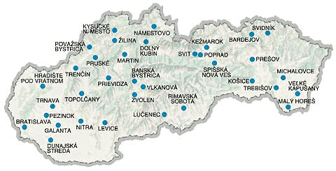
- Deployment
Funkctions of MicroKataster
- Data collection by digitizing the underlying raster map
- Modification of graphic and descriptive data
- Creating objects from existing graphic information
- Processing of object surfaces (calculation of surfaces, intersections of parcel surfaces, etc.)
- Processing of parcel lists
- Bulk operations (changing the appearance of lines, texts, attribute values, etc.)
- Creation of drawing documentation
- Checking the correctness of cadastral map data
- Services (compression, merging, generation, and correction of cadastral map data)
- Defining map sheets 1:5000, 1:2000, 1:1000 and 1:2880
- Transformation of raster map sheets (according to specified identification points)
- Two-way data transformation between vgi and dgn formats
- Data export to the RVP database system
- Defining user lines and symbols
Features of MicroKataster
- It is object-oriented. Each graphic element has associated semantics, which means information determining the link to the object. For example, the parcel object includes the perimeter line, number, and mark of the land type of the parcel.
- It works in the JTSK coordinate system.
- It has predefined all the marks and user lines commonly used in the cadastral map. Predefined marks and user lines can be supplemented and modified at will.
- It enables rapid digitization by switching to probable states, saving time for choosing the next action.
- It has a context-driven user interface. In each state, only the necessary interactive windows are displayed, the others are automatically turned off.
- Its activity is configurable. By setting the parameter values in the configuration and description files, the behavior of the application is controlled, without the need for programming interventions.
- It allows users to connect to the real estate cadastre database, display them interactively, and generate reports.
Conditions of operation
- MS Windows NT/2000
- MicroStation/95, MicroStation SE, MicroStation PowerDraft
- Pentium, min. 32 MB RAM
- mouse or tablet
Deployment

Choose what you need from our products
- Services
- Consulting and analyses in power industry
- Processing of technical data
- Processing of graphic data
- Processing of CAD data
- Sale and installation of software
- Sale and installation of hardware
- Accredited certification services for electronic signature
- Double-entry bookkeeping, maintenance of personnel and payroll agenda
- Solutions
- Virtual reality
- Energy trading
- Electricity dispatching
- Facility management and maintenance
- Devices and equipment lifecycle management
- Technological networks management
- Technical documentation maintenance
- Road network management
- Energetic networks design
- Maps, atlases and other map works
- References
- Technical information systems
- Trading information systems for power industry
- Consulting and analyses in power industry
- Graphic applications
- Cartography
- CAD
- Professional portals
- sféra workshops
- Legislative obligations
- ENERGOKLUB®
- ENERGOFÓRUM®

